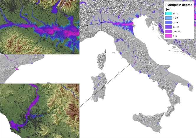
Insurance use case: The Italial map of flood flow depths and damages
GRIDDIT is supporting ANIA (Association of Italian Insurance Companies) by providing flood modelling expert knowledge and datasets to map inundation hazard (the maximum flow depths and the potential damage) for the entire Italian territory. GRIDDIT data and tools empower the Flood Risk section of the ANIA GEOSAFE platform.
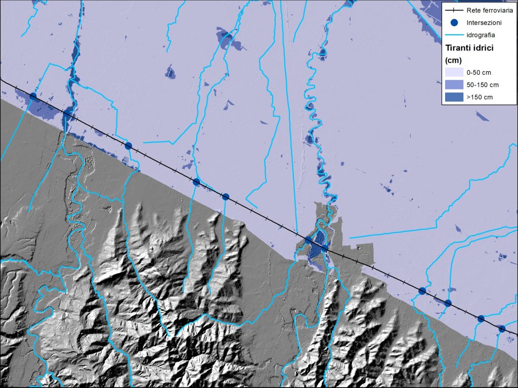
Infrastructure use case: mapping critical transportation assets at flood risk
GRIDDIT is working with transportation asset organizations by applying a geospatial processing method deliving flood risk matrix assessment at large scale. Thousands of kilometres of a railways analyzed and mapped for assessing flood risk perils and critical river-asset intersections.